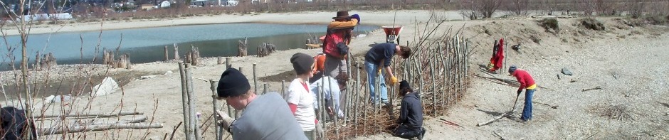
In April of every year for five years (2011-2015) the Selkirk College Integrated Environmental Planning class has undertaken three days of shoreline stabilization / ecosystem restoration work on the Nelson waterfront (Kootenay Lake). Most of the work has occurred on one of the several man-made peninsulas located adjacent to the airport and along the city dog-walk trail. The banks of this peninsula were eroding at a rapid rate (up to two feet+ per year in places) prior to commencing this work, but now have been largely stabilized. The work finished in 2015 brought this multi-year project to completion. Both the City of Nelson (logistical and financial support) and Columbia Basin Trust (through the Environmental Initiatives Program) have been partners in this project.
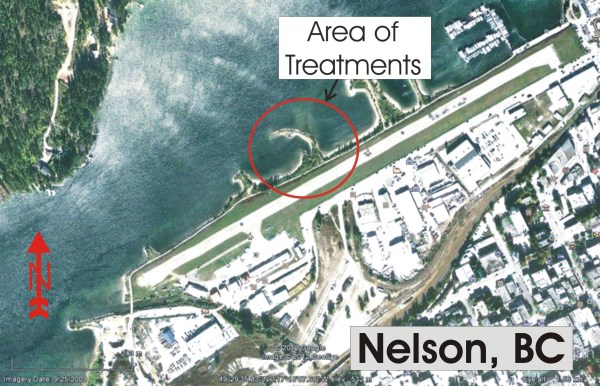
You may also wish to the refer to the map of treatment locations (will open in new tab) on the peninsula when observing the photos below. Also, Branch Box Breakwaters are referred to simply as “Breakwaters” here.
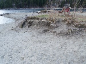
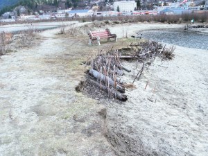
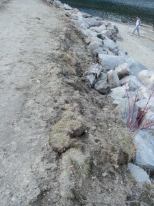
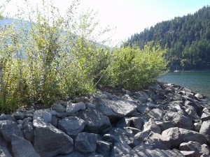
The Peninsula Before Work Started (Photos taken April 3, 2011)
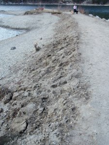
Above left: Area of 2011 breakwater. The loose fill material here was very susceptible to wave-induced erosion during seasonal high water (June/July) – which is typically up to the top of the bank here or higher. Above right: Area of 2013 breakwater.
*********************************************************************
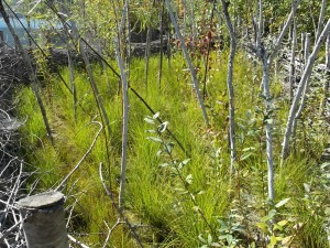
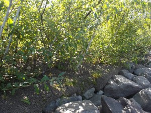
Above left: Coir log placement area in 2013. A small amount of shoreline erosion control work was done here in the spring of 2010 (seen here). This consisted of live willow staking and log placement / shoreline branch packing to absorb wave energy. This was only moderately effective but some of these willow have survived. Above right: Area of 2012 and 2015 Breakwaters. The end of the peninsula was experiencing very rapid soil erosion.
*********************************************************************
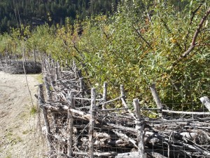
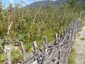
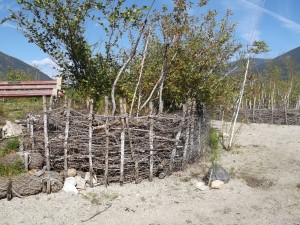
Above left: Area of 2013 soil wrap. The soil on this peninsula is very sandy and infertile. Above right: Area of 2011 breakwater on right, and 2014/2015 soil wraps on left.
*********************************************************************
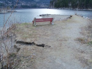
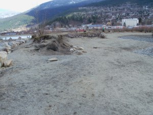
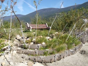
Above left: Area of 2014 soil wrap. Above right: View of peninsula surface behind bench.
*********************************************************************
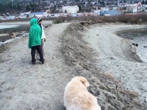
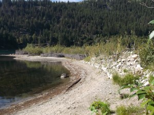
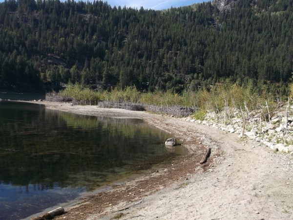
The Peninsula in September of 2015
The photos of the peninsula shown below were taken on September 10, 2015 (unless otherwise indicated). A note regarding the breakwater structures – all but two of these were constructed both to 1) reduce wave impact on the bank, the cause of soil erosion here, and also 2) to provide a sheltered place for plants to establish and for young fish to feed when the water is high. Two of these however were constructed only for the second of these reasons, as the bank was already protected by an earlier breakwaters. These two structures are called “Sand Bar Breakwaters” below.
The wood species planted are Sitka willow (Salix sitchensis) and Sandbar willow (Salix exigua, minor component) and Red-osier dogwood (Cornus sericea). The planted sedges are Lakeshore sedge (Carex lenticularis).
Links to instructions for building each structure are below.
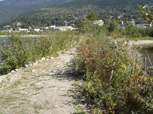
Above left: South-west side of peninsula. Right: North -east side of peninsula.
*********************************************************************
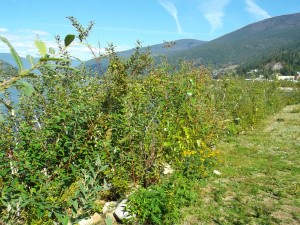
Above left: 2011 breakwater and growth of planted willow and red-osier dogwood. Above Right: Planted sedges behind the 2011 breakwater seen here.
*********************************************************************
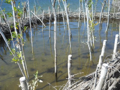
Left: Small fish were seen in the sheltered area behind the 2011 breakwater during the summer of 2014 (July). Water levels remained relatively low in 2015 so this area was not flooded.
Zoom lower left corner of photo to see numerous fish.
*********************************************************************
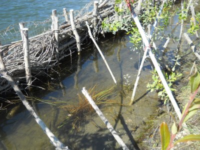
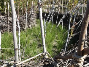
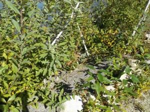
Above left: 2014 sand bar breakwater. The purpose of this structure was to create a sheltered place for planted sedges to establish and for fish to feed during high water (see below). The bank behind here was already protected from wave-induced erosion by the 2011 structure. Above Right: Robust sedge growth inside the 2014 sand bar breakwater. There are two seasons of growth on these sedges. Tall rooted cuttings were planted inside the structure as well.
*********************************************************************
Left: Numerous small fish inside the 2014 sand bar breakwater during the summer of 2014 (July 10). Water levels remained relatively low in 2015 so this area are did not become flooded (2015 was a drought year). Note: This area was flooded in 8 of the last 10 years. Zoom to see numerous fish.
*********************************************************************
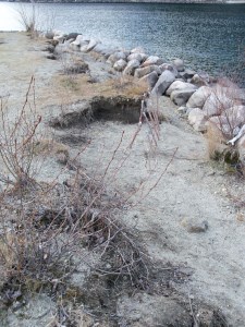
Above left: 2013 breakwater (back-filled). Above Right: 2013 Coir log placement area in front of bench.
*********************************************************************
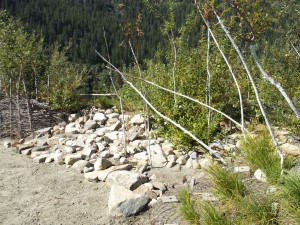
Above left: 2013 breakwater (back-filled). Above right: 2013 Manual rip-rap placement area, and with some sedges in the 2013 Coir log placement area seen in the foreground.
*********************************************************************
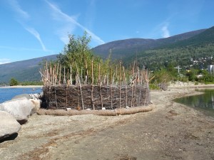
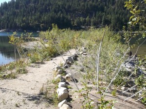
Above left: 2015 sand bar breakwater around the end of the peninsula. This was constructed in front of the 2012 Breakwater to provide a second layer of protection and also create a sheltered environment for vegetation to establish. Above right: Sedges inside the 20 sand bar breakwater; these have one season of growth here. Tall rooted cuttings were also planted here. The 2012 breakwater is seen behind.
*********************************************************************
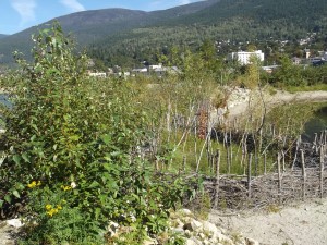
Above left: 2013 soil wrap area. The rich compost material placed here (see Treatment Descriptions below) has resulted in very rapid establishment and growth here. Above right: 2013 Soil Wrap. The coir fabric is 3 seasons old here and still in good shape. There is abundant natural regeneration of willow and cottonwood (some seen here) all along the peninsula now.
*********************************************************************
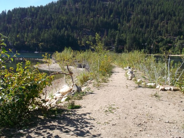
Above left: View of 2014 sand bar breakwater from behind the bench. The survival of rooted cuttings here after two seasons is good (90%+). Above right: View looking back down the peninsula with the soil wrap treatment areas on the left side and the 2011 breakwater-protected area on the right.
*********************************************************************
Above left: View of 2014 and 2013 soil wrap areas as you would see them from the water. Above right: Here the coir matting is three seasons old and still too tough to stab a spade through. An extensive root mat will hold the bank here once this matting does decay (within next few years).
*********************************************************************
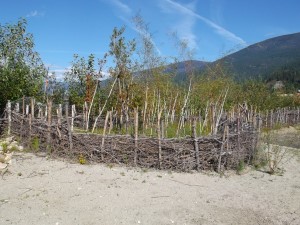
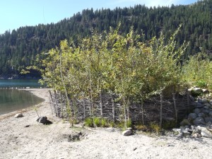
 Above: Overview of the peninsula, Sept. 10, 2015. Great work Selkirk College IEP Students!
*********************************************************************
Summary of Treatments
Links to instruction for constructing the various structures shown above are below: